
PROPERTY-INSURANCE CLAIM HELP · FL & SC FL CITIESSC CITIESGUIDESTATESNEWSSITE MAPABOUT
HurricaneLaw.Pro HURRICANELAW.PRO
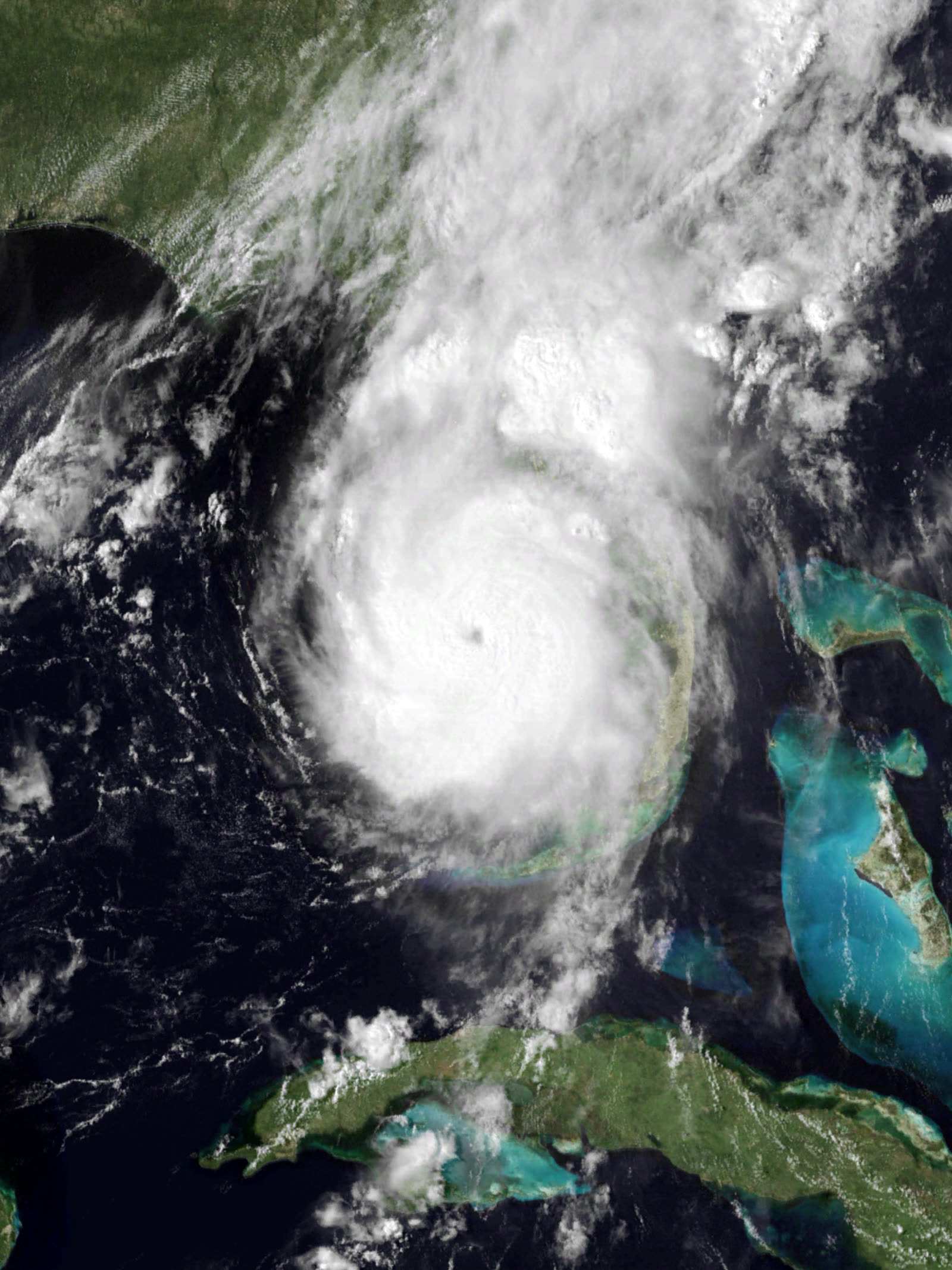
Charley at Category 4 intensity making landfall near Cayo Costa, 1945 UTC, August 13, 2004
STORM ARCHIVE / 2004 LANDFALL 26.6°N 82.2°W
CAT 4 FL & SC · 2004 · 150 mph

Hurricane Charley

Landfall: Cayo Costa / Punta Gorda, FL; 2nd landfall near Cape Romain, SC · 2004-08-13. A court ruling weeks before landfall — Mierzwa — put full policy limits on the table for mixed-peril total losses; the 2005 Legislature rewrote the Valued Policy Law in response

NOAA / NASA (GOES-12)
AT LANDFALL
CAT 4
PEAK WIND
150 mph
PRESSURE
941 mb
STORM SURGE
6–7 ft
DAMAGE
~$16B
DEATHS
10
01 THE PATH

Where it hit, start to finish

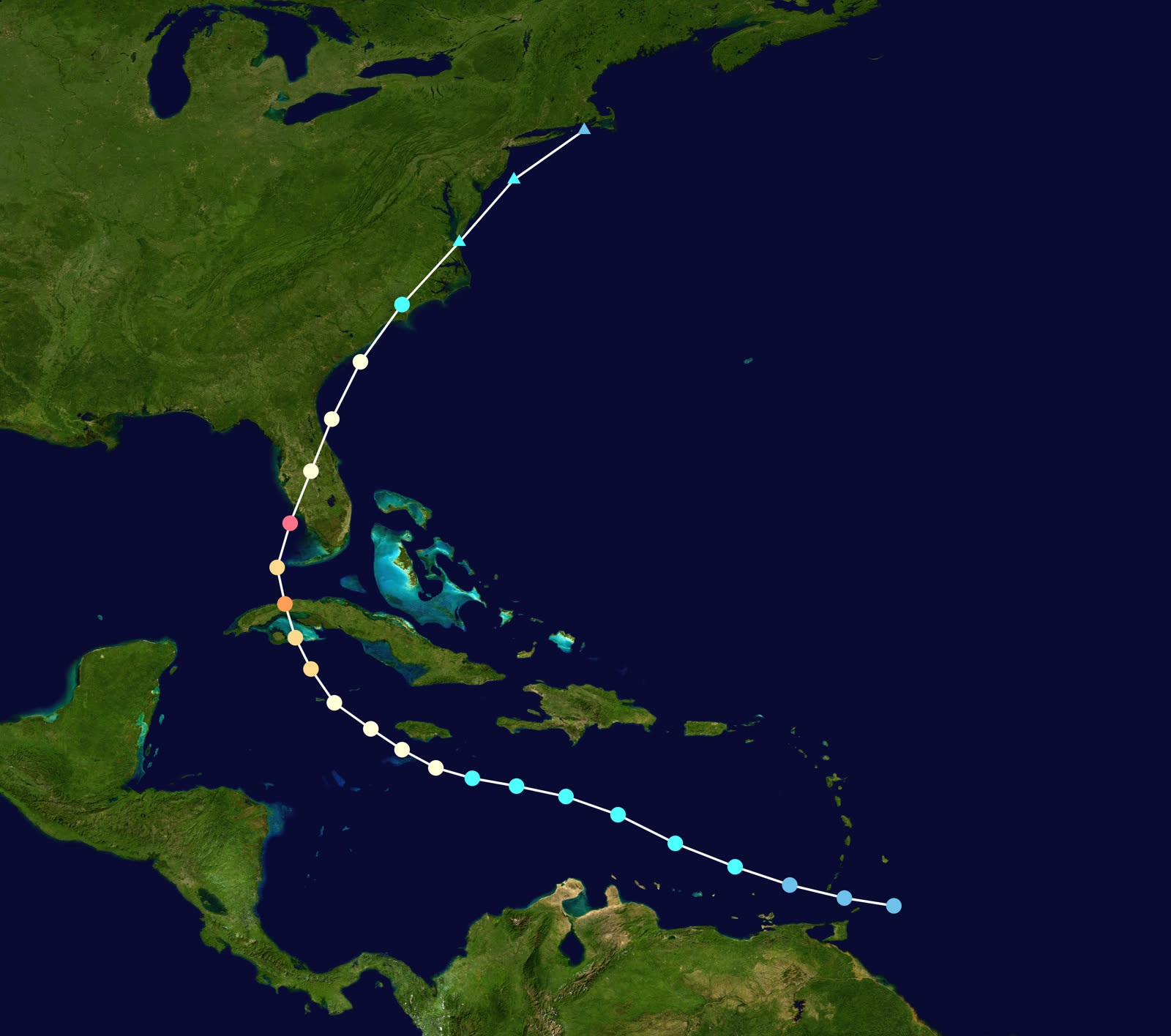
TRACK · HURRICANE CHARLEYNOAA / NHC (best-track data)
Best track and Saffir-Simpson intensity of Hurricane Charley, August 9–14, 2004
Southwest Caribbean / Cuba
RAPID STRENGTHENING

Charley crossed western Cuba as a hurricane August 13, producing a 13.1-ft storm surge at Playa Cajio, then accelerated north-northeastward at 18 mph toward Florida's west coast.

Cayo Costa, FL
CAT 4 LANDFALL — 150 MPH

In the final hours Charley's eye shrank and its winds jumped to 150 mph; the extreme core was confined to within about 6 nautical miles of the center. Landfall came at 1945 UTC August 13 at 941 mb — the strongest US landfall since Andrew in 1992.

Punta Gorda / Port Charlotte, FL
CATASTROPHIC WIND CORE

The eyewall crossed Charlotte Harbor an hour later. The Punta Gorda wind sensor measured a 97-kt gust, then failed. Mobile home parks and older commercial strips were leveled; damage in Charlotte County was catastrophic.

Orlando / Central FL
HURRICANE WINDS INLAND

Moving fast, Charley crossed the peninsula in about seven hours and carried damaging winds through Arcadia, Wauchula, Kissimmee, and Orlando — wind damage deep inland that most Central Florida policyholders had never claimed for.

Cape Romain / North Myrtle Beach, SC
SECOND US LANDFALL

Charley came ashore again August 14 — near Cape Romain around 1400 UTC (70 kt) and North Myrtle Beach around 1600 UTC (65 kt) — adding roof, tree, and dock claims along the Grand Strand.

Mid-Atlantic
DISSIPATION

Charley weakened over the Carolinas and was absorbed by a front on August 15. Direct US deaths: 10. Total damage estimate: ~$15–16 billion nominal — at the time the second-costliest US hurricane on record.

02 THE RECORD IN IMAGES
ALL IMAGERY U.S. GOV / PUBLIC DOMAIN
RADAR NOAA / NWS
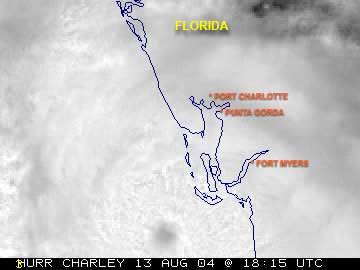
Tampa radar loop of Charley's small, well-defined eye crossing the coast at Cayo Costa
AERIAL FEMA / Andrea Booher
FEMA aerial of destroyed homes in Punta Gorda, where Charley's eyewall crossed with 145+ mph winds
SATELLITE NASA / NOAA
Charley off the Carolinas on August 14, hours after its second US landfall near Cape Romain, SC

The storm

Charley was small, fast, and late-turning. After crossing western Cuba on August 13, 2004, it accelerated toward Florida at 18 mph on a forecast track aimed at Tampa Bay. In the final hours it did two things at once: it turned right, and it exploded — Category 2 to Category 4, with the eye shrinking so much that 150 mph winds were confined to within about 6 nautical miles of the center.

Landfall came at 1945 UTC on August 13 near Cayo Costa, just north of Captiva, at 941 mb — the strongest hurricane to strike the US since Andrew in 1992. An hour later the eyewall was over Punta Gorda, where the airport wind sensor recorded a 97-kt gust and then failed. Because Charley was compact and quick, surge was modest — 6 to 7 feet estimated on Sanibel and Estero Islands — and this was overwhelmingly a wind event. Charley crossed the peninsula in about seven hours, exited near Daytona Beach, then made a second US landfall August 14 near Cape Romain, South Carolina, and again at North Myrtle Beach. Ten direct US deaths.
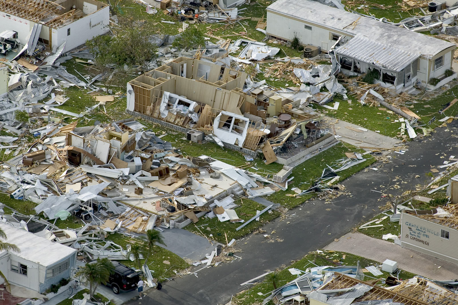
FEMA aerial of destroyed homes in Punta Gorda, where Charley's eyewall crossed with 145+ mph winds
FEMA aerial of destroyed homes in Punta Gorda, where Charley's eyewall crossed with 145+ mph winds FEMA / Andrea Booher

The damage

Charlotte County took the core: Punta Gorda and Port Charlotte lost mobile home parks, older strip commercial, and thousands of roofs to eyewall winds. Damage ran far inland along the track — Arcadia, Wauchula, Kissimmee, Orlando — because Charley's speed left little time for weakening. Nine tornadoes touched down across the peninsula the same day.

The insured tally: Property Claim Services counted $6.755 billion insured in Florida plus smaller totals in the Carolinas; the NHC's revised total damage estimate is about $15.1 billion nominal. Homes built to the newer Florida Building Code fared visibly better than pre-Andrew construction — a data point that shaped code debates for the next decade.
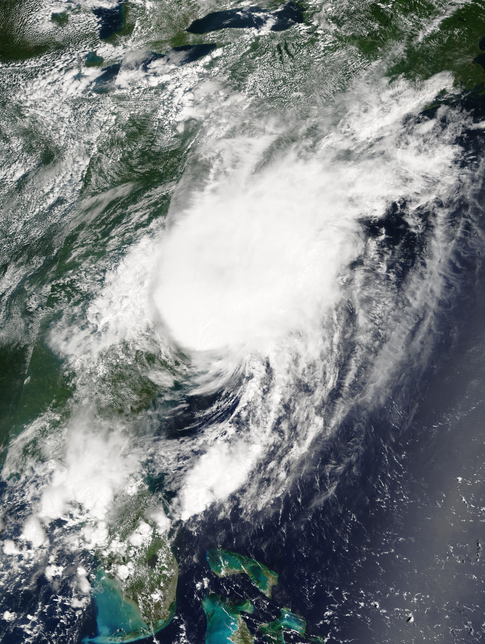
Charley off the Carolinas on August 14, hours after its second US landfall near Cape Romain, SC
Charley off the Carolinas on August 14, hours after its second US landfall near Cape Romain, SC NASA / NOAA

The insurance aftermath

Charley opened a four-storm season that generated roughly 2.2 million claims and about $21 billion in insured losses across Charley, Frances, Ivan, and Jeanne — the first time four hurricanes hit one state since Texas in 1886.

The defining legal fight was already teed up when Charley arrived. Weeks earlier, Florida's Fourth DCA had decided Mierzwa v. Florida Windstorm Underwriting Association: under Florida's Valued Policy Law, if a building was a total loss and a covered peril (wind) contributed to it, the carrier owed the full face amount of the policy — even if an excluded peril like flood caused much of the damage. For total losses across the 2004 storms, policyholders demanded policy limits under Mierzwa; carriers projected enormous uncovered exposure. In 2005 the Legislature amended § 627.702 — the so-called "Mierzwa fix" — clarifying that an insurer pays only for loss caused by the covered peril. Claims that predated the amendment continued to be litigated on the old language for years.

Charley also started the deductible clock. Florida hurricane deductibles are percentage-based, and tens of thousands of Central Florida homes hit by Charley were struck again by Frances and Jeanne within six weeks — each storm triggering a separate deductible. The outcry led to a December 2004 special session reimbursement program and, in 2005, a single calendar-year hurricane deductible (see the Frances dossier). Citizens Property Insurance ended 2004 in deficit, triggering assessments on policyholders statewide — the start of the residual-market growth that defined the next two decades.
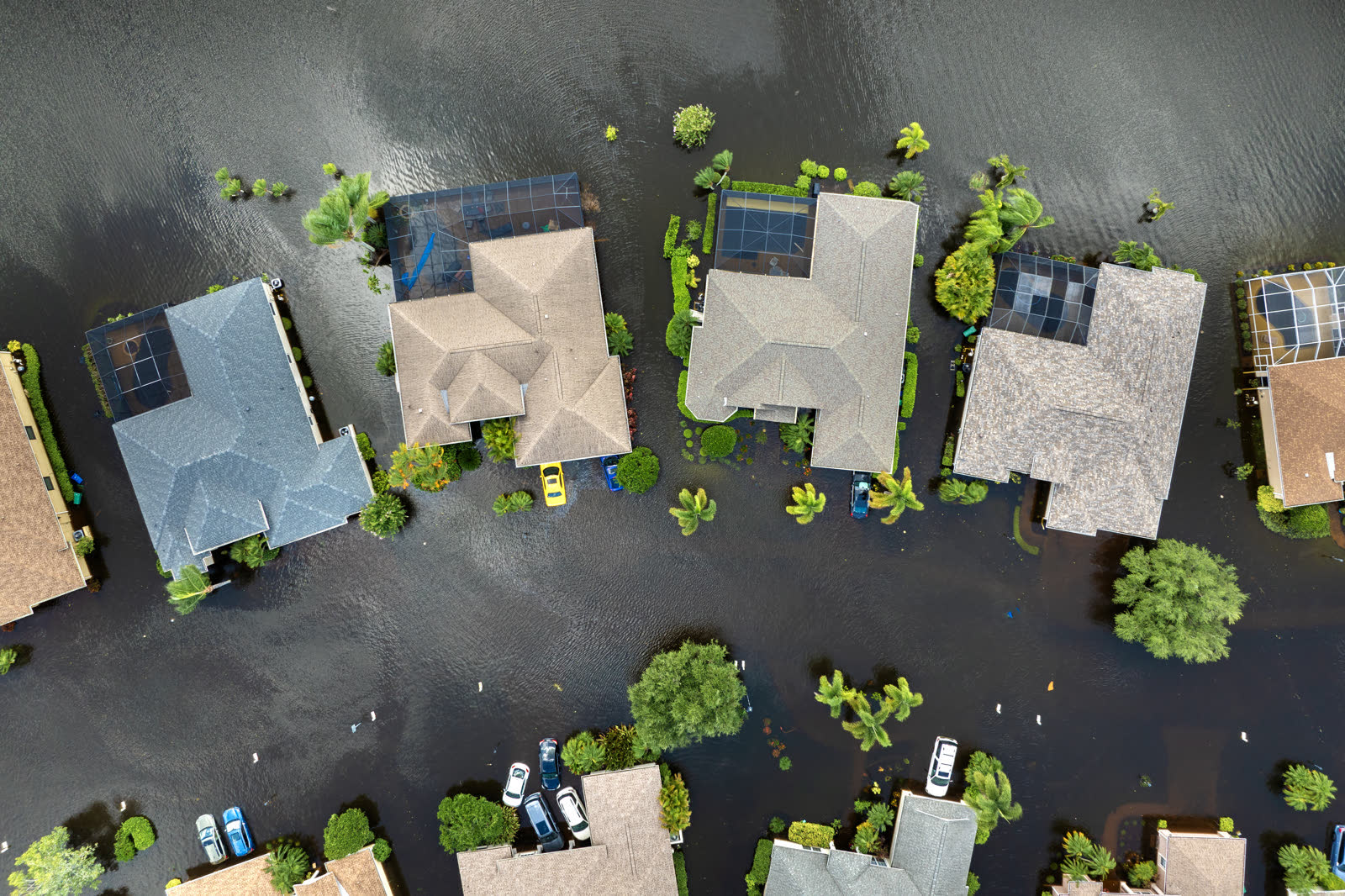
Tropical-storm flooding, Florida
Tropical-storm flooding, Florida HURRICANELAW.PRO FIELD FOOTAGE

What policyholders learned

  • Wind damage travels inland. Orlando-area owners had claims as legitimate as coastal ones; carriers that scoped only "coastal" damage patterns underpaid inland roofs. Independent inspections closed the gap.
  • Total-loss claims had VPL leverage. Policyholders whose homes were destroyed invoked Mierzwa to claim full policy limits; the argument worked until the 2005 amendment, and pre-2005 claims kept the leverage.
  • Failed instruments meant contested wind speeds. With the Punta Gorda sensor dead at peak, carriers and policyholders both leaned on engineering reports; owners who photographed damage before cleanup fared better in causation disputes.
  • Fast storms still create long claims. Charley's claim tail ran years — supplements for hidden roof and truss damage found during repairs were common and generally compensable.
  • Deductible receipts mattered. Owners who documented what they paid out of pocket under Charley's deductible could later claim reimbursement for second-storm deductibles under the state's 2004 program.

Independent informational resource — not legal advice. Damage figures are nominal (not inflation-adjusted) unless noted. Insurance-law summaries are drafted for education; consult an attorney about your specific claim.

AT LANDFALL · HURRICANE CHARLEY · 2004
6–7 ft
OF STORM SURGE · SANIBEL AND ESTERO ISLANDS
HURRICANELAW.PRO FIELD FOOTAGE
03 THE FULL RECORD

Every official record of Charley

Reports, imagery archives, flood data, and claims records — straight from the agencies.

OUR LAW FIRM PARTNER · HALVERSEN LAW
Charley claim denied?
CALL FL941-390-3233CALL SC843-542-0454FREE CLAIM REVIEW
RELATED GUIDES
HurricaneLaw.Pro HURRICANELAW.PRO

The independent policyholder resource for Florida & South Carolina — storm archive, coverage law, denials, bad faith, and the complete claims playbook. 51 storms · 46 carriers · 97 public-adjuster firms · 37 city guides.

▸ SEE THE FULL SITE MAP — EVERY PAGE →
STORM ALERTS SOURCED FROM NOAA / NHC
SOUTH CAROLINA
496 Bramson Court, Suite 100
Mount Pleasant, SC 29464
CALL OR TEXT
FLORIDA
Tampa, FL
CALL OR TEXT
CLAIMS 9
DENIALS 8
BAD FAITH 7
COVERAGE 12
COMMERCIAL 8
ROOFS 8
TREES 5
DIRECTORIES
STORMS 51
WEATHER
NEWS & SITE 19
STORM ARCHIVE, CITIES & NEWS
Most recent below. Every storm dossier, city resource, and article is on its hub (linked at each heading) or the grouped site map →. All 46 carriers and 97 public-adjuster firms are in the Directories column above.
STORM ARCHIVE · 51 →
Hurricane Debby 2024Hurricane Helene 2024Hurricane Milton 2024Hurricane Idalia 2023Hurricane Ian 2022Hurricane Nicole 2022Hurricane Ida 2021Hurricane Laura 2020 View all 51 →
FLORIDA CITY RESOURCES · 29 →
Boca RatonBradentonCape CoralClearwaterDaytona BeachDestinFort LauderdaleFort Myers View all 29 →
SOUTH CAROLINA CITY RESOURCES · 8 →
BeaufortCharlestonColumbiaFlorenceGreenvilleHilton Head IslandMount PleasantMyrtle Beach
NEWS & UPDATES · 19 →

HurricaneLaw.Pro is an independent informational resource, not a law firm. Coverage summaries, policy-language quotations, dollar figures, deadlines, and chart examples throughout this site are general information based on typical or standard policy forms and are illustrative only — they are not a quote, a guarantee of coverage, or a promise of any outcome. Every insurance policy is different: your own policy, endorsements, and state law control, so read your policy and confirm current statutes. Weather imagery courtesy of NOAA, the National Hurricane Center, and the National Weather Service. Legal services are provided by our law firm partner, Halversen Law. Nothing on this site is legal advice; consult an attorney about your specific claim.

PrivacyTermsDisclaimerAboutContact
© 2026 HURRICANELAW.PRO — ALL RIGHTS RESERVED 27.9°N 82.5°W · ATLANTIC BASIN MONITOR
OUR LAW FIRM PARTNER
Halversen Law LICENSED · FLORIDA & SOUTH CAROLINA

All legal matters on this site are referred to and handled by our law firm partner, Halversen Law, a licensed law firm in Florida and South Carolina. HurricaneLaw.Pro is an informational resource and is not itself a law firm.

FREE CASE REVIEW