
PROPERTY-INSURANCE CLAIM HELP · FL & SC FL CITIESSC CITIESGUIDESTATESNEWSSITE MAPABOUT
HurricaneLaw.Pro HURRICANELAW.PRO
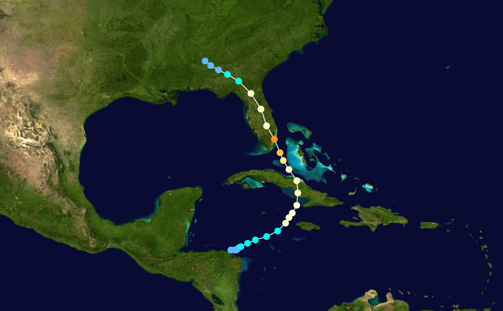
Track of Hurricane King, October 13–20, 1950 — from the western Caribbean over Cuba to a landfall on downtown Miami
STORM ARCHIVE / 1950 LANDFALL 25.7°N 80.2°W
CAT 4 FL · 1950 · 130 mph

Hurricane King

Landfall: Downtown Miami, FL · 1950-10-18. A Category 4 core five miles wide through downtown Miami — 20,861 homes damaged — still cited as the benchmark for concentrated urban wind exposure

NOAA / NHC (best-track data)
AT LANDFALL
CAT 4
PEAK WIND
130 mph
PRESSURE
955 mb
DAMAGE
~$28M (1950)
DEATHS
4 (US)
01 THE PATH

Where it hit, start to finish

TRACK · HURRICANE KINGNOAA / NHC (best-track data)
Best track and intensity of Hurricane King, October 1950
Western Caribbean
OCTOBER DEVELOPMENT

King organized off Honduras on October 13, 1950, became a tropical storm October 14, and reached hurricane strength between Jamaica and the Cayman Islands on October 16.

Camagüey, Cuba
FIRST LANDFALL

The hurricane crossed central Cuba near Camagüey, killing seven, then intensified sharply over the Florida Straits.

Coconut Grove / Downtown Miami
CAT 4 THROUGH THE CITY CORE

Landfall near Grove Isle at 05:00 UTC October 18 — 130-mph peak winds, 955 mb, an eye contracted to five miles. The narrow core ran straight up the urban spine of Miami; contemporaries compared the damage strip to a giant tornado track.

Southern Florida
20,861 HOMES DAMAGED

King damaged 20,861 houses in southern Florida — 580 severely — and destroyed 248 more. Damage: about $28 million (1950), $15 million of it in metro Miami, plus ~$3 million in citrus losses.

North Florida / Georgia
INLAND DECAY

Still at hurricane strength over north-central Florida on October 18–19, King weakened crossing Georgia — one death there — and dissipated over Alabama on October 20.

02 THE RECORD IN IMAGES
ALL IMAGERY U.S. GOV / PUBLIC DOMAIN
MAP NOAA / U.S. Weather Bureau
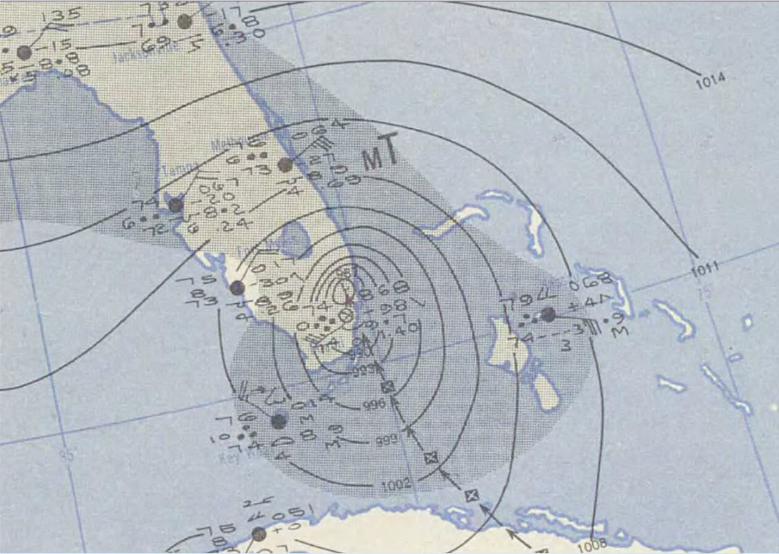
U.S. Weather Bureau surface map, October 18, 1950 — King centered over southern Florida
MAP NOAA
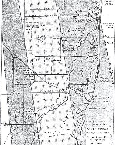
Swath of King's damaging winds across the Florida peninsula — a corridor only miles wide
MAP NOAA / NHC (best-track data)
Full Atlantic track of Hurricane King with Saffir-Simpson intensity coding

The storm

King was a late-season Caribbean hurricane in the first year Atlantic storms carried names. It formed off Honduras on October 13, 1950, reached hurricane strength between Jamaica and the Caymans on the 16th, and crossed central Cuba near Camagüey, killing seven there.

Over the Florida Straits it intensified fast and shrank as it did — by landfall the eye had contracted to about five miles across. King came ashore near Grove Isle in Coconut Grove at 05:00 UTC on October 18 (just after midnight locally) and drove its core directly over downtown Miami: peak winds of 130 mph, central pressure 955 mb. The modern HURDAT reanalysis upgraded King's Miami landfall to Category 4 — making it the strongest hurricane to strike the city between 1926 and Andrew's near-miss geography in 1992.

The compact storm held hurricane intensity far up the peninsula, weakened over Georgia, and dissipated over Alabama on October 20.
Swath of King's damaging winds across the Florida peninsula — a corridor only miles wide
Swath of King's damaging winds across the Florida peninsula — a corridor only miles wide NOAA

The damage

King's signature was concentration. Instead of a broad windfield, it cut a corridor of extreme damage a few miles wide north through Miami, Fort Lauderdale, and the lake region — contemporaries compared the strip to an enormous tornado track. Outside the corridor, damage fell off rapidly; inside it, the storm damaged 20,861 houses in southern Florida, 580 of them severely, and destroyed 248.

The ledger: about $28 million in 1950 dollars, with $15 million in metro Miami and roughly $3 million in citrus — a serious blow landing weeks before harvest. The U.S. toll was 4 dead and 199 injured, low for the intensity because the storm was small, moved through fast, and hit a city with fresh hurricane memory.
Full Atlantic track of Hurricane King with Saffir-Simpson intensity coding
Full Atlantic track of Hurricane King with Saffir-Simpson intensity coding NOAA / NHC (best-track data)

The insurance aftermath

King hit a very different insurance market than 1926 had. The postwar boom had filled South Florida with mortgaged tract homes, and mortgage lenders required fire policies with extended-coverage endorsements — which covered windstorm. So for the first time in a major Miami hurricane, tens of thousands of wind claims flowed through carriers rather than relief agencies: over 21,000 damaged or destroyed dwellings, most carrying some wind coverage.

The claims pattern King produced became a template. A narrow, severe swath through dense housing meant adjusters were grading roof damage street by street — total roof losses one block from homes with shingle scatter — an early rehearsal of the partial-roof and matching disputes that dominate Florida wind claims today. The citrus loss, by contrast, was largely uninsured; federal crop insurance of the era did not meaningfully cover Florida groves.

For the emerging science of wind engineering, King became a reference event: a measured Category 4 core over an instrumented city, in the same season Hurricane Easy had drenched Cedar Key. The 1950 season pushed the Weather Bureau's radar and reconnaissance investments, and King's tight-core damage profile fed the wind-load studies that hardened South Florida's building code line from the 1950s onward. When rate-makers and modelers stress-test "a small, intense hurricane over an urban core," King is the historical Florida case they reach for.

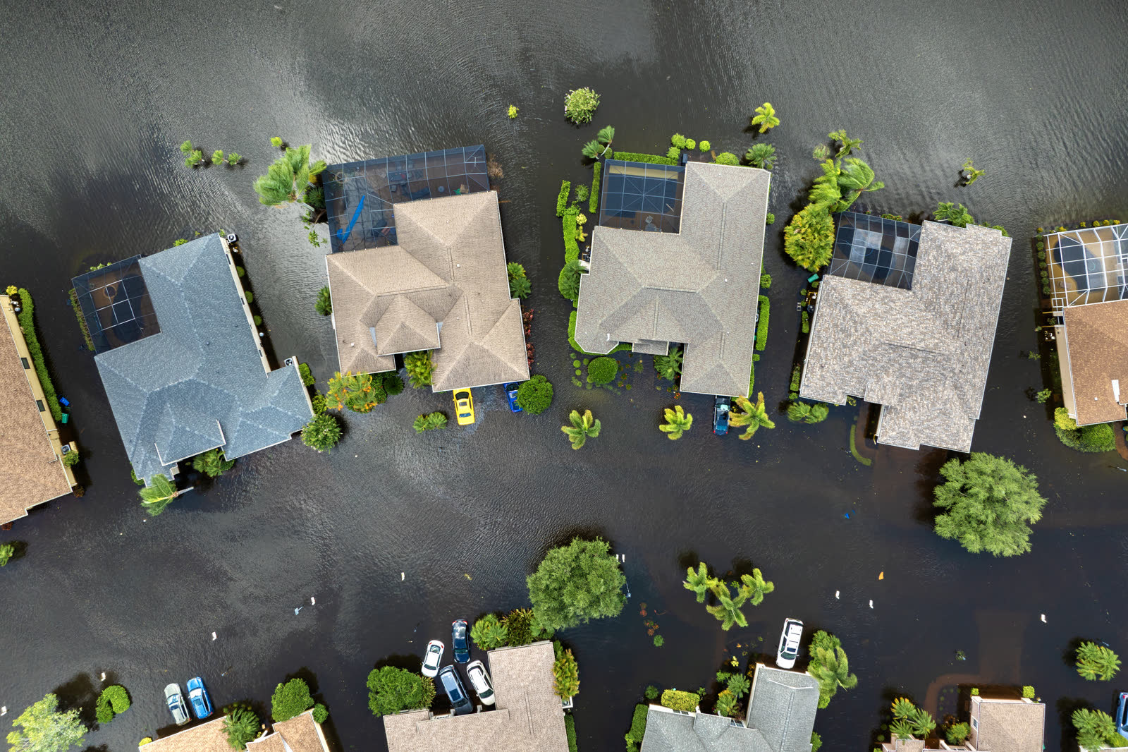
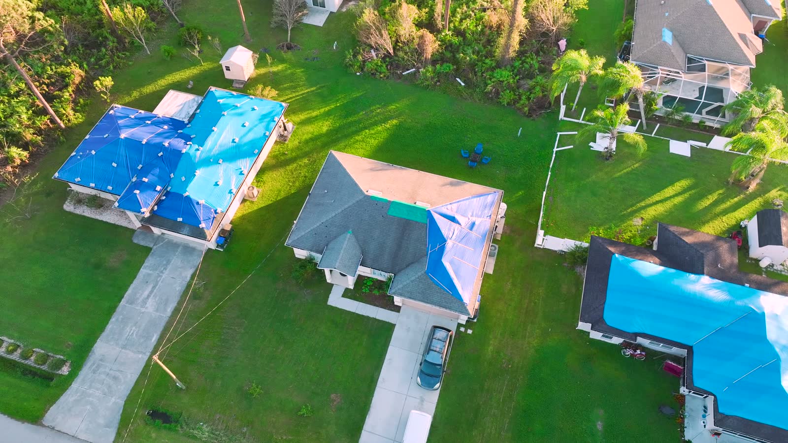
Tropical-storm flooding, Florida
Tropical-storm flooding, Florida HURRICANELAW.PRO FIELD FOOTAGE

What policyholders learned

  • Small storms are not small claims. King's compact core produced 21,000+ damaged homes in hours. Windfield size predicts how many claims; core intensity predicts how bad yours is.
  • Street-level damage gradients invite lowball grading. Where severity changes block by block, adjusters extrapolate from the wrong block. Roof-level photos of your specific damage beat neighborhood generalizations.
  • Nighttime landfalls leave documentation gaps. King struck after midnight; owners saw damage only at dawn. Pre-storm photos are what establish the before/after when nobody witnessed the event.
  • Crop and landscaping losses ride outside the homeowners policy. King's citrus losses went largely unpaid — trees, plants, and landscaping still carry tight sublimits today.
  • An urban benchmark cuts both ways. King proves a Cat 4 core can cross downtown Miami; it anchors both the engineering standards protecting newer buildings and the exposure math behind South Florida premiums.

Independent informational resource — not legal advice. Damage figures are nominal (not inflation-adjusted) unless noted. Insurance-law summaries are drafted for education; consult an attorney about your specific claim.

AT LANDFALL · HURRICANE KING · 1950
130 mph
SUSTAINED WINDS
HURRICANELAW.PRO FIELD FOOTAGE
03 THE FULL RECORD

Every official record of King

Reports, imagery archives, flood data, and claims records — straight from the agencies.

OUR LAW FIRM PARTNER · HALVERSEN LAW
King claim denied?
CALL FL941-390-3233CALL SC843-542-0454FREE CLAIM REVIEW
RELATED GUIDES
HurricaneLaw.Pro HURRICANELAW.PRO

The independent policyholder resource for Florida & South Carolina — storm archive, coverage law, denials, bad faith, and the complete claims playbook. 51 storms · 46 carriers · 97 public-adjuster firms · 37 city guides.

▸ SEE THE FULL SITE MAP — EVERY PAGE →
STORM ALERTS SOURCED FROM NOAA / NHC
SOUTH CAROLINA
496 Bramson Court, Suite 100
Mount Pleasant, SC 29464
CALL OR TEXT
FLORIDA
Tampa, FL
CALL OR TEXT
CLAIMS 9
DENIALS 8
BAD FAITH 7
COVERAGE 12
COMMERCIAL 8
ROOFS 8
TREES 5
DIRECTORIES
STORMS 51
WEATHER
NEWS & SITE 19
STORM ARCHIVE, CITIES & NEWS
Most recent below. Every storm dossier, city resource, and article is on its hub (linked at each heading) or the grouped site map →. All 46 carriers and 97 public-adjuster firms are in the Directories column above.
STORM ARCHIVE · 51 →
Hurricane Debby 2024Hurricane Helene 2024Hurricane Milton 2024Hurricane Idalia 2023Hurricane Ian 2022Hurricane Nicole 2022Hurricane Ida 2021Hurricane Laura 2020 View all 51 →
FLORIDA CITY RESOURCES · 29 →
Boca RatonBradentonCape CoralClearwaterDaytona BeachDestinFort LauderdaleFort Myers View all 29 →
SOUTH CAROLINA CITY RESOURCES · 8 →
BeaufortCharlestonColumbiaFlorenceGreenvilleHilton Head IslandMount PleasantMyrtle Beach
NEWS & UPDATES · 19 →

HurricaneLaw.Pro is an independent informational resource, not a law firm. Coverage summaries, policy-language quotations, dollar figures, deadlines, and chart examples throughout this site are general information based on typical or standard policy forms and are illustrative only — they are not a quote, a guarantee of coverage, or a promise of any outcome. Every insurance policy is different: your own policy, endorsements, and state law control, so read your policy and confirm current statutes. Weather imagery courtesy of NOAA, the National Hurricane Center, and the National Weather Service. Legal services are provided by our law firm partner, Halversen Law. Nothing on this site is legal advice; consult an attorney about your specific claim.

PrivacyTermsDisclaimerAboutContact
© 2026 HURRICANELAW.PRO — ALL RIGHTS RESERVED 27.9°N 82.5°W · ATLANTIC BASIN MONITOR
OUR LAW FIRM PARTNER
Halversen Law LICENSED · FLORIDA & SOUTH CAROLINA

All legal matters on this site are referred to and handled by our law firm partner, Halversen Law, a licensed law firm in Florida and South Carolina. HurricaneLaw.Pro is an informational resource and is not itself a law firm.

FREE CASE REVIEW