
PROPERTY-INSURANCE CLAIM HELP · FL & SC FL CITIESSC CITIESGUIDESTATESNEWSSITE MAPABOUT
HurricaneLaw.Pro HURRICANELAW.PRO
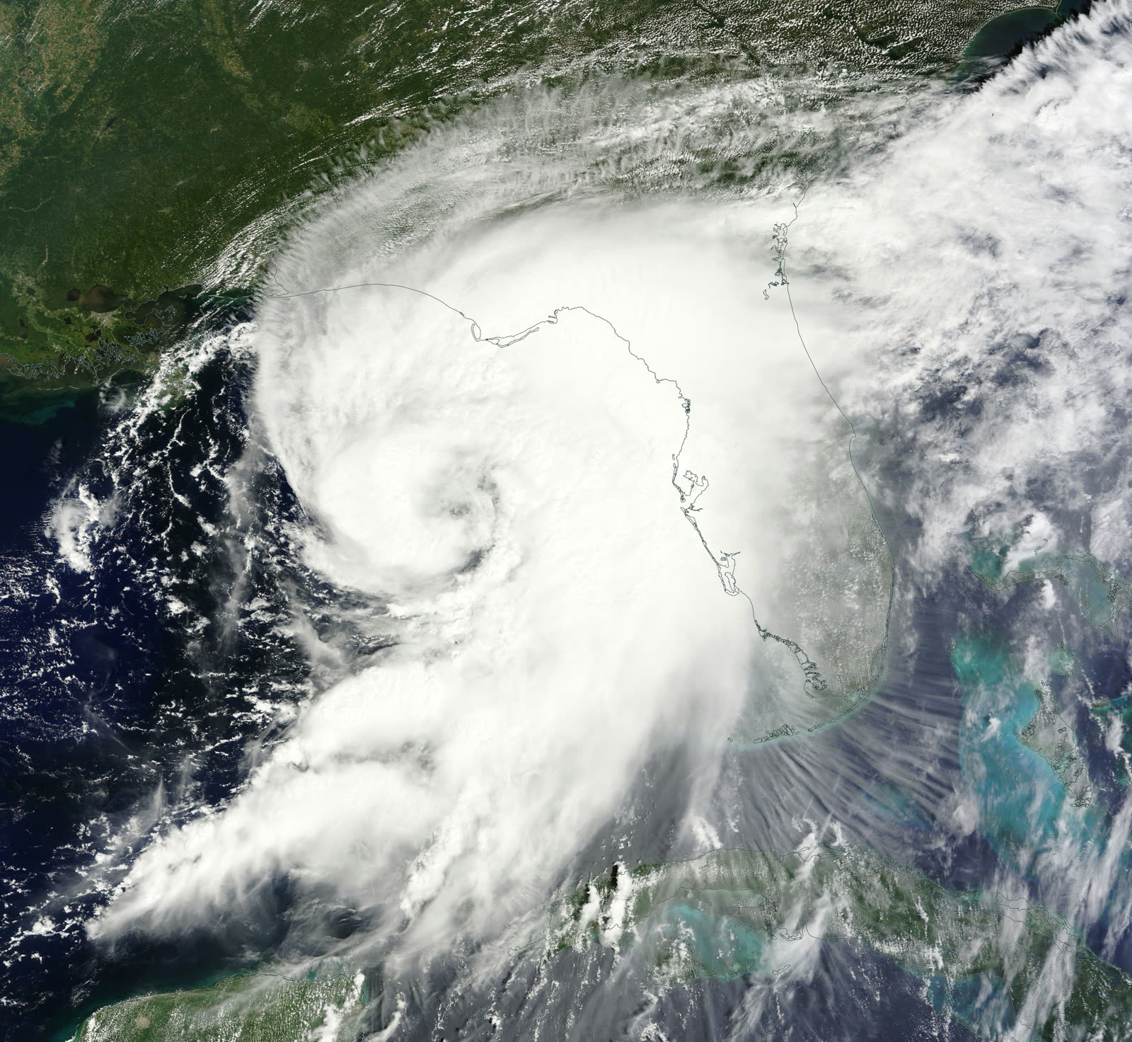
Hermine strengthening in the eastern Gulf on September 1, 2016, hours before its Big Bend landfall
STORM ARCHIVE / 2016 LANDFALL 30.1°N 84.2°W
CAT 1 FL · 2016 · 80 mph

Hurricane Hermine

Landfall: St. Marks, FL (eastern Apalachee Bay) · 2016-09-02. Ended Florida's 11-year hurricane drought — and insurers' first estimates put nearly a third of the loss in coastal flooding most homeowners policies excluded

NASA (Terra/MODIS)
AT LANDFALL
CAT 1
PEAK WIND
80 mph
PRESSURE
981 mb
STORM SURGE
about 6 ft
DAMAGE
~$550M
DEATHS
3
01 THE PATH

Where it hit, start to finish

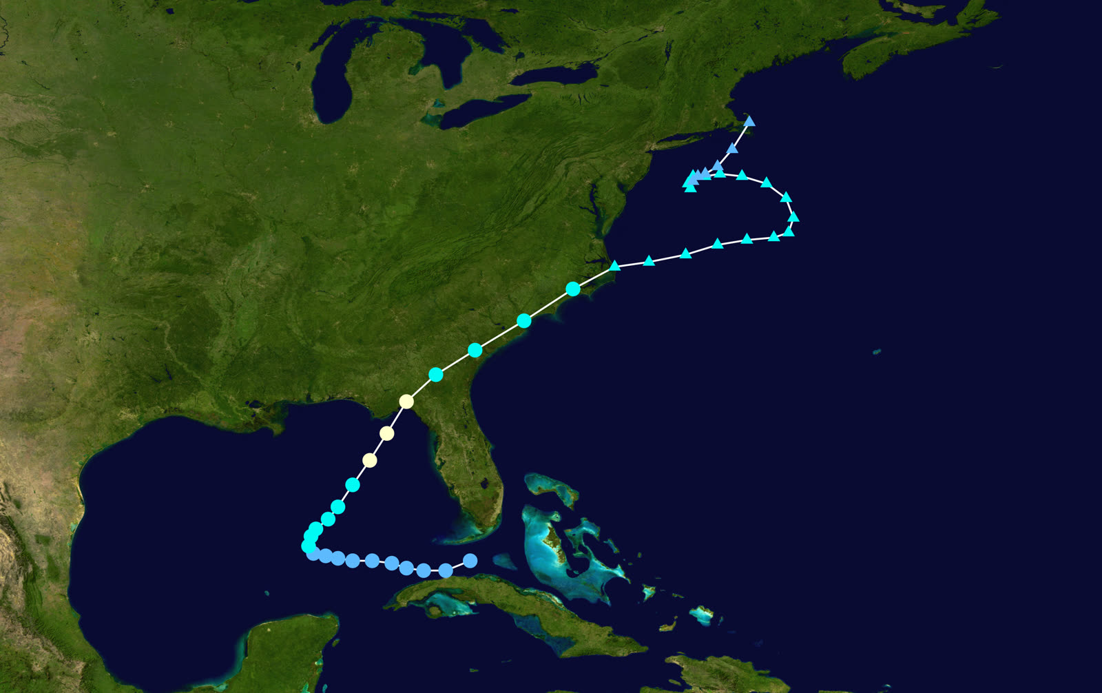
TRACK · HURRICANE HERMINENOAA / NHC (best-track data)
Best track of Hurricane Hermine, August 28 - September 8, 2016
Eastern Gulf of Mexico
SLOW ORGANIZATION, LATE STRENGTHENING

Hermine wandered the Gulf for days as a depression before finally reaching hurricane strength on September 1 — Florida's first hurricane threat after a record 11-year landfall drought.

Pasco / Citrus counties, FL
FEEDER-BAND FLOODING BEFORE LANDFALL

Outer bands dropped over 10 inches of rain on the Tampa Bay area's northern suburbs; the Anclote River pushed hundreds of Pasco County homes into days of freshwater flooding.

St. Marks / Apalachee Bay, FL
CAT 1 LANDFALL - 80 MPH

Landfall about 1:30 a.m. EDT September 2 near St. Marks at 80 mph and 981 mb. Storm surge ran roughly 6 feet at Cedar Key and pushed water into waterfront communities from Keaton Beach to St. Marks.

Tallahassee, FL
WORST CITY OUTAGE SINCE KATE (1985)

Hermine's core crossed Tallahassee with hurricane-force gusts. Falling trees crushed roofs and lines; roughly 80% of city utility customers lost power, some for a week.

Georgia / Carolinas coast
INLAND DECAY, COASTAL EXIT

Hermine weakened over south Georgia, dropped heavy rain along the I-95 corridor, and exited near the Outer Banks before looping offshore as a post-tropical storm through September 8. Three deaths were tied to the storm.

02 THE RECORD IN IMAGES
ALL IMAGERY U.S. GOV / PUBLIC DOMAIN
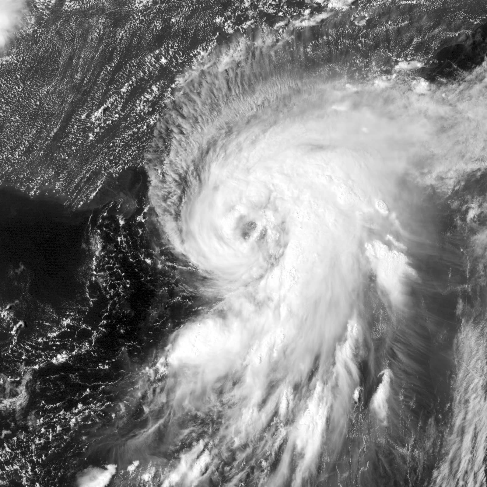
SATELLITE US Naval Research Laboratory
Enhanced satellite view of Hermine reaching hurricane strength in the Gulf, September 1, 2016
RADAR NOAA / NWS
Radar at 10:38 p.m. EDT September 1 as Hermine's eye approached the St. Marks coast
CONE NOAA / NHC
NHC five-day forecast cone as Hermine organized in the Gulf
DAMAGE Wikimedia Commons (public domain)
Wind damage to Watson Temple church in Tallahassee, where Hermine knocked out power to most of the city
OTHER US Coast Guard
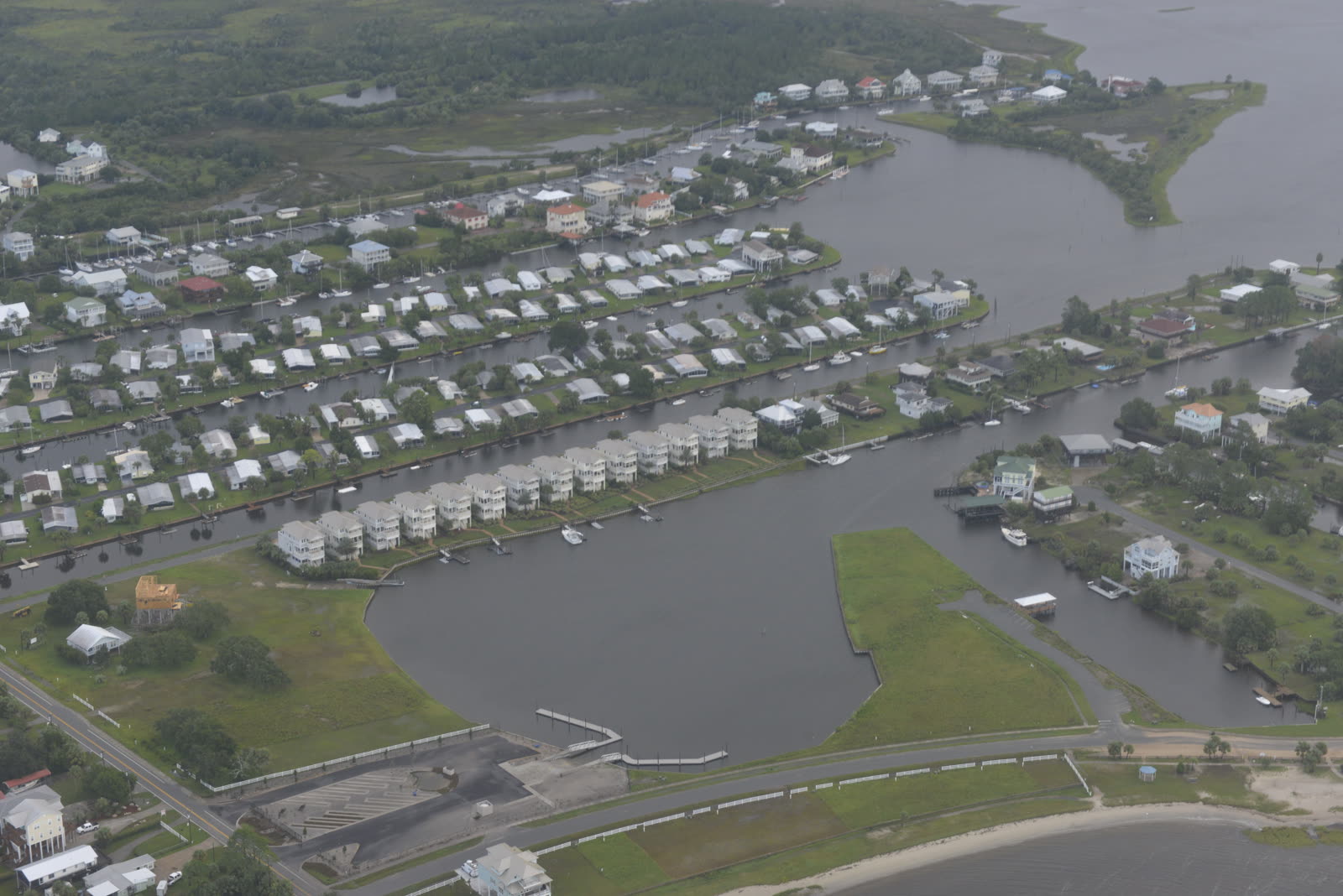
Coast Guard Ocean Sentry crew flying a post-Hermine damage survey over the affected coast, September 2, 2016

The storm

Hermine spent most of its life underachieving. The system crossed the Caribbean and Gulf for days as a poorly organized depression before finally intensifying on September 1, 2016, in the warm eastern Gulf. It reached hurricane strength that evening — the first hurricane to threaten a Florida landfall since Wilma in October 2005.

Landfall came about 1:30 a.m. EDT on September 2 near St. Marks, at the eastern end of Apalachee Bay: Category 1, 80 mph, 981 mb. The 11-year Florida hurricane drought — the longest on record for any state — was over.

The footprint was classic Big Bend. Surge of roughly 6 feet at Cedar Key and along the coastal bends from Keaton Beach to St. Marks; hurricane-force gusts through Tallahassee; and, well before landfall, feeder bands that dropped more than 10 inches of rain on Pasco and Hernando counties, flooding hundreds of homes along the Anclote River. Hermine then crossed Georgia and the Carolinas and lingered offshore of the Mid-Atlantic for nearly a week as a post-tropical storm. Three deaths and roughly $550 million in damage were attributed to the storm.
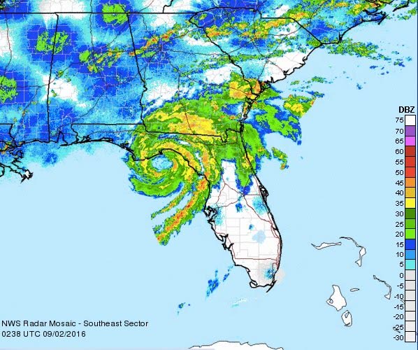
Radar at 10:38 p.m. EDT September 1 as Hermine's eye approached the St. Marks coast
Radar at 10:38 p.m. EDT September 1 as Hermine's eye approached the St. Marks coast NOAA / NWS

The damage

Tallahassee took the most visible hit of any city. The capital sits 25 miles inland, but Hermine's core passed directly over it in the dark, and the city's dense tree canopy became the story: oaks and pines onto roofs, cars, and power lines. Roughly 80% of city utility customers lost power, and restoration stretched a week — the city's worst storm outage since Kate in 1985.

On the coast, surge damaged or inundated low-lying homes at Cedar Key, Keaton Beach, Dekle Beach, and St. Marks — the same communities Idalia, Debby, and Helene would hit far harder in 2023-24. In Pasco County, the freshwater flooding along the Anclote was a flood-insurance event: rising water, days of standing water, mostly outside the wind claim entirely.
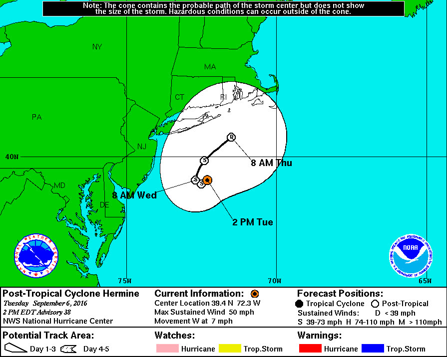
NHC five-day forecast cone as Hermine organized in the Gulf
NHC five-day forecast cone as Hermine organized in the Gulf NOAA / NHC

The insurance aftermath

Hermine was a moderate loss with an outsized paper trail, because it was Florida's first hurricane claims test in over a decade.

The numbers: catastrophe modeler RMS put insured losses below $400 million; Karen Clark & Co. estimated close to $500 million and more than 50,000 claims, against roughly $1 billion in total economic damage. FLOIR's own data call — activated by emergency order OIR-16-07M in October 2016 — tallied about $139 million in reported insured losses by March 2017. The gap between modeled and reported losses reflects what modelers flagged at the time: roughly 30% of the event loss was coastal flooding, and most of it had no policy response because surge is excluded from homeowners forms.

The claim-level patterns previewed the decade that followed. Hurricane deductibles — percentage-based, typically 2-5% of dwelling limit — were triggered statewide because Hermine was a named hurricane, so tens of thousands of modest wind claims closed below deductible. Policyholders in Pasco's river flooding learned the flood exclusion the hard way; NFIP take-up inland was thin. And Hermine's claims cycle fed Florida's then-accelerating assignment-of-benefits (AOB) wave: water-remediation and roofing contractors soliciting signed-over claims, a practice the legislature would not rein in until 2019-2022.

For the Big Bend, Hermine also set a marker. The region's low insurance penetration and older housing stock produced a small insured loss relative to visible damage — the same mismatch that Idalia would expose at triple the scale seven years later.
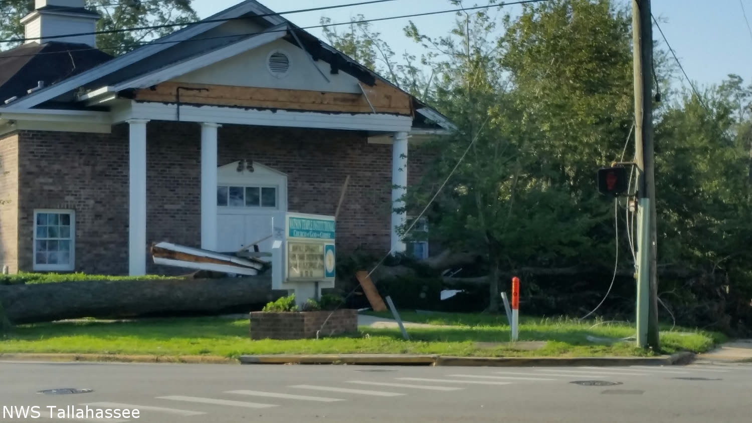
Wind damage to Watson Temple church in Tallahassee, where Hermine knocked out power to most of the city
Wind damage to Watson Temple church in Tallahassee, where Hermine knocked out power to most of the city Wikimedia Commons (public domain)

What policyholders learned

  • A "small" hurricane still triggers the big deductible. Named-hurricane percentage deductibles applied statewide; owners who documented all damage — not just the obvious tree strike — were likelier to clear the threshold.
  • Coastal flood vs. wind decided Big Bend outcomes. Roughly a third of Hermine's loss was surge and coastal flooding, excluded from homeowners policies. Flood policies, not wind arguments, were what paid at Cedar Key and St. Marks.
  • Tree claims have two parts. Removal is capped by sublimit (often $500-$1,000); damage to the structure the tree hit is covered at full repair cost. Tallahassee owners who separated the two in their claims recovered more.
  • Inland river flooding is a flood claim, full stop. Pasco's Anclote River losses fell entirely on NFIP policies and FEMA assistance where owners were uninsured.
  • Sign nothing at the door. Hermine-era AOB solicitation stripped many owners of control of their own claims — a pattern regulators spent the next six years unwinding.

Independent informational resource — not legal advice. Damage figures are nominal (not inflation-adjusted) unless noted. Insurance-law summaries are drafted for education; consult an attorney about your specific claim.

AT LANDFALL · HURRICANE HERMINE · 2016
about 6 ft
OF STORM SURGE · CEDAR KEY
HURRICANELAW.PRO FIELD FOOTAGE
03 THE FULL RECORD

Every official record of Hermine

Reports, imagery archives, flood data, and claims records — straight from the agencies.

OUR LAW FIRM PARTNER · HALVERSEN LAW
Hermine claim denied?
CALL FL941-390-3233CALL SC843-542-0454FREE CLAIM REVIEW
RELATED GUIDES
HurricaneLaw.Pro HURRICANELAW.PRO

The independent policyholder resource for Florida & South Carolina — storm archive, coverage law, denials, bad faith, and the complete claims playbook. 51 storms · 46 carriers · 97 public-adjuster firms · 37 city guides.

▸ SEE THE FULL SITE MAP — EVERY PAGE →
STORM ALERTS SOURCED FROM NOAA / NHC
SOUTH CAROLINA
496 Bramson Court, Suite 100
Mount Pleasant, SC 29464
CALL OR TEXT
FLORIDA
Tampa, FL
CALL OR TEXT
CLAIMS 9
DENIALS 8
BAD FAITH 7
COVERAGE 12
COMMERCIAL 8
ROOFS 8
TREES 5
DIRECTORIES
STORMS 51
WEATHER
NEWS & SITE 19
STORM ARCHIVE, CITIES & NEWS
Most recent below. Every storm dossier, city resource, and article is on its hub (linked at each heading) or the grouped site map →. All 46 carriers and 97 public-adjuster firms are in the Directories column above.
STORM ARCHIVE · 51 →
Hurricane Debby 2024Hurricane Helene 2024Hurricane Milton 2024Hurricane Idalia 2023Hurricane Ian 2022Hurricane Nicole 2022Hurricane Ida 2021Hurricane Laura 2020 View all 51 →
FLORIDA CITY RESOURCES · 29 →
Boca RatonBradentonCape CoralClearwaterDaytona BeachDestinFort LauderdaleFort Myers View all 29 →
SOUTH CAROLINA CITY RESOURCES · 8 →
BeaufortCharlestonColumbiaFlorenceGreenvilleHilton Head IslandMount PleasantMyrtle Beach
NEWS & UPDATES · 19 →

HurricaneLaw.Pro is an independent informational resource, not a law firm. Coverage summaries, policy-language quotations, dollar figures, deadlines, and chart examples throughout this site are general information based on typical or standard policy forms and are illustrative only — they are not a quote, a guarantee of coverage, or a promise of any outcome. Every insurance policy is different: your own policy, endorsements, and state law control, so read your policy and confirm current statutes. Weather imagery courtesy of NOAA, the National Hurricane Center, and the National Weather Service. Legal services are provided by our law firm partner, Halversen Law. Nothing on this site is legal advice; consult an attorney about your specific claim.

PrivacyTermsDisclaimerAboutContact
© 2026 HURRICANELAW.PRO — ALL RIGHTS RESERVED 27.9°N 82.5°W · ATLANTIC BASIN MONITOR
OUR LAW FIRM PARTNER
Halversen Law LICENSED · FLORIDA & SOUTH CAROLINA

All legal matters on this site are referred to and handled by our law firm partner, Halversen Law, a licensed law firm in Florida and South Carolina. HurricaneLaw.Pro is an informational resource and is not itself a law firm.

FREE CASE REVIEW