PROPERTY-INSURANCE CLAIM HELP · FL & SC FL CITIESSC CITIESGUIDESTATESNEWSSITE MAPABOUT
HurricaneLaw.Pro HURRICANELAW.PRO
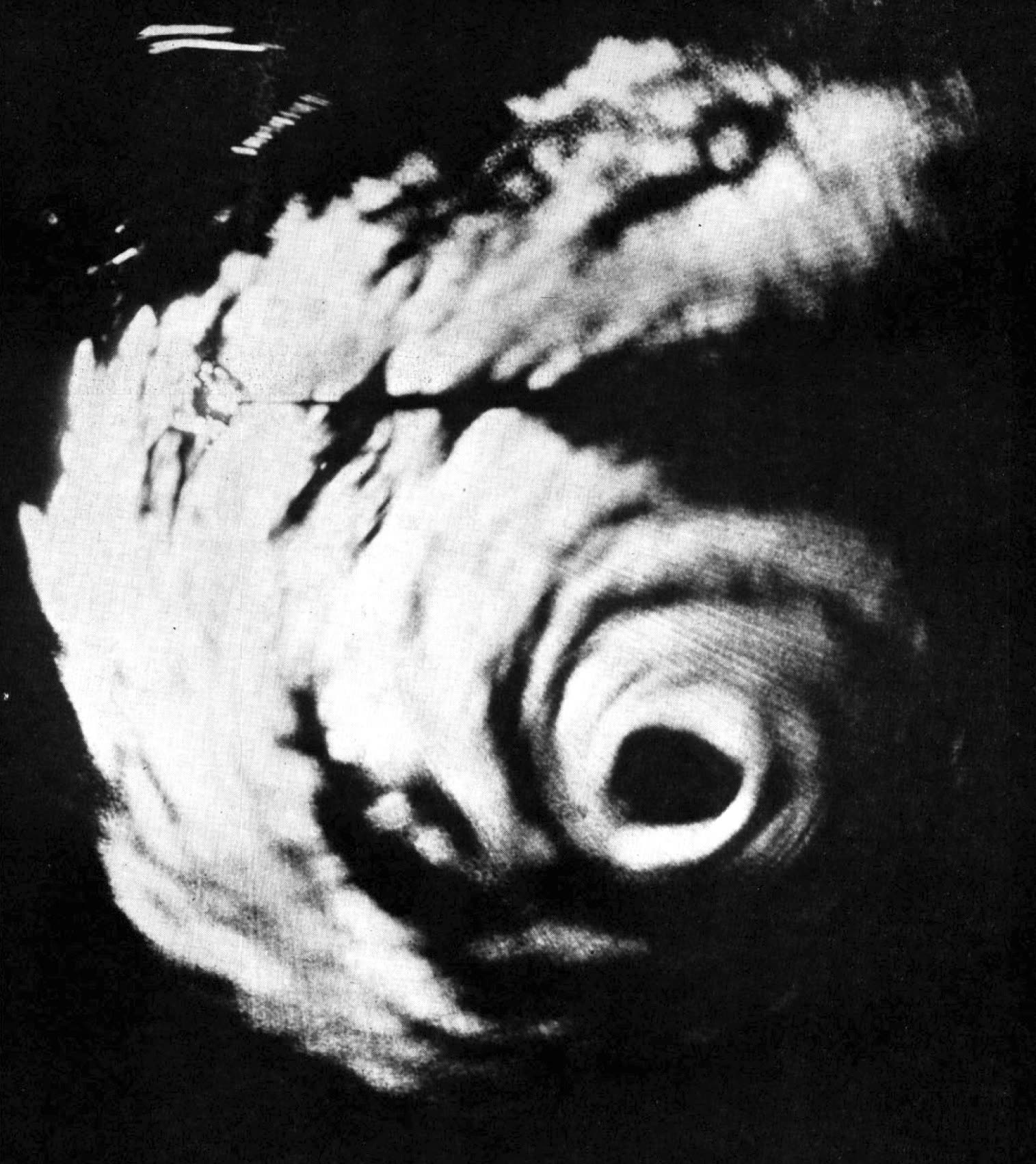
Gracie's eye on a U.S. Navy radar scope as the hurricane closed on the South Carolina coast, September 1959
STORM ARCHIVE / 1959 LANDFALL 32.5°N 80.4°W
CAT 4 SC · 1959 · 140 mph

Hurricane Gracie

Landfall: St. Helena Sound, SC (near Edisto Island) · 1959-09-29. The last major hurricane to hit South Carolina before Hugo — a 30-year gap that drained coastal storm experience from owners, carriers, and adjusters alike

U.S. Navy
AT LANDFALL
CAT 4
PEAK WIND
140 mph
PRESSURE
950 mb
STORM SURGE
11.9 ft
DAMAGE
~$14M
DEATHS
22 (10 SC/GA, 12 VA tornadoes)
01 THE PATH

Where it hit, start to finish

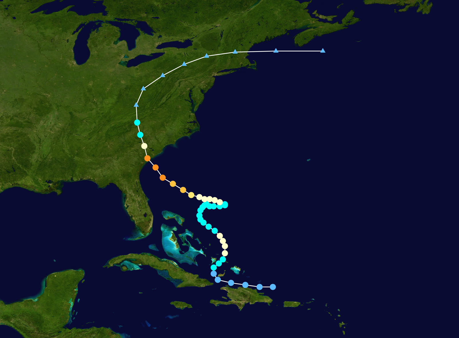
TRACK · HURRICANE GRACIENOAA / NHC (best-track data)
Best track and Saffir-Simpson intensity of Hurricane Gracie, September 20-30, 1959 — five days of erratic motion, then a run at the SC coast
North of Hispaniola
FIVE DAYS OF ERRATIC MOTION

Gracie formed near Hispaniola on September 20, 1959 and wandered for five days — forecasters called it one of the most difficult storms to predict of the era — before intensifying on a northwest track toward the SC coast.

Offshore SC
PEAK - 140 MPH

Gracie peaked at 140 mph the morning of September 29 as it closed the last miles to the coast, deepening to 950 mb.

St. Helena Sound / Edisto Island, SC
CAT 4 LANDFALL - 130 MPH

Landfall at midday September 29 over St. Helena Sound near the south end of Edisto Island, with winds near 130 mph. Surge reached 11.9 feet along the southern SC coast — blunted by arrival near low tide.

Beaufort, SC
WORST OF THE WIND

Beaufort took the strongest winds: roofs opened, windows shattered, trees and poles down across the town. Ten people died in South Carolina and Georgia, and Charleston recorded its highest tide since 1940.

Charlottesville, VA
TORNADOES IN THE REMNANTS

Inland, Gracie's remnants dropped 13.20 inches of rain at Big Meadows, VA and spawned six tornadoes; three F3s near Charlottesville killed 12 people — more than died in the landfall state.

Mid-Atlantic
EXTRATROPICAL

Gracie went extratropical on September 30. South Carolina's coast would not take another major hurricane until Hugo, 30 years later — and Hugo's eyewall crossed nearly the same stretch of coast.

02 THE RECORD IN IMAGES
ALL IMAGERY U.S. GOV / PUBLIC DOMAIN
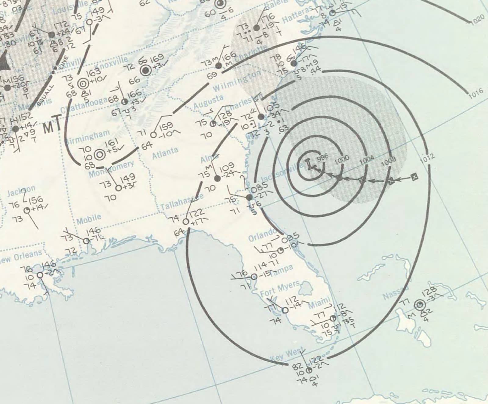
MAP NOAA Central Library / U.S. Weather Bureau
U.S. Weather Bureau surface analysis as Gracie struck St. Helena Sound at Category 4, September 29, 1959
MAP NOAA Central Library / U.S. Weather Bureau
Full daily weather map for September 29, 1959 — Gracie at the coast with high pressure blocking to the north
MAP NOAA / WPC
Gracie's rainfall footprint — 13.20 inches at Big Meadows, VA, where the remnants spawned deadly tornadoes

The storm

Gracie formed near the north coast of Hispaniola on September 20, 1959, and spent five days wandering — north, then west, then stalling — while forecasters called it one of the most difficult storms of the era to predict. On September 28 it finally organized on a steady northwest track, and it intensified to the very end: 140 mph on the morning of September 29 as it closed the last miles to the coast.

Landfall came at midday on September 29 over St. Helena Sound, near the southern end of Edisto Island, as a Category 4 with winds near 130 mph and a central pressure of 950 mb. Two pieces of luck held the toll down: the strongest winds crossed a lightly built stretch of coast between Beaufort and Charleston, and the storm arrived near low tide. Surge still reached 11.9 feet above mean lower low water along the southern coast, and Charleston recorded its highest tide since 1940 — but a Hazel-style high-tide landfall would have rewritten the outcome.

Gracie weakened quickly inland and went extratropical on September 30 — but not before its remnants killed more people in Virginia than the hurricane had at the coast.
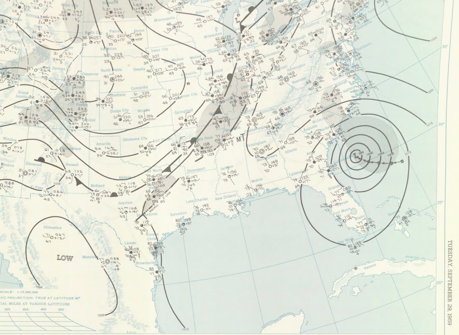
Full daily weather map for September 29, 1959 — Gracie at the coast with high pressure blocking to the north
Full daily weather map for September 29, 1959 — Gracie at the coast with high pressure blocking to the north NOAA Central Library / U.S. Weather Bureau

The damage

Wind did the damage in South Carolina. Beaufort took the worst of it: roofs stripped and opened, windows shattered, streetlights and utility poles down, trees through houses across the town and the surrounding sea islands — the same islands the 1893 storm had drowned. Edisto Beach's oceanfront took structural and severe erosion damage; post-storm renourishment there was improvised by excavating inland marsh, an approach with lasting environmental costs. Ten people died in South Carolina and Georgia, most from falling trees and storm cleanup.

Inland, the remnants dropped 13.20 inches of rain at Big Meadows, Virginia, and spawned six tornadoes on September 30. Three F3s near Charlottesville killed 12 — Gracie's single deadliest stroke, 400 miles from landfall.

Total damage: about $14 million (1959 dollars) — severe locally, modest overall, because the Category 4 core missed the era's concentrations of coastal property.
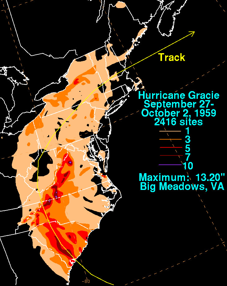
Gracie's rainfall footprint — 13.20 inches at Big Meadows, VA, where the remnants spawned deadly tornadoes
Gracie's rainfall footprint — 13.20 inches at Big Meadows, VA, where the remnants spawned deadly tornadoes NOAA / WPC

The insurance aftermath

Gracie's direct insurance footprint was small — wind losses in a thinly developed coastal county, paid under standard extended-coverage policies of the day. Its real significance for the South Carolina insurance market is what it started: a 30-year silence. From September 29, 1959 until Hugo on September 21, 1989, no major hurricane struck the state.

Those three decades saw the Grand Strand and the sea islands transform from fishing villages and cottages into a dense resort and retirement coast — Hilton Head's development began the same decade Gracie hit. Nearly all of that property was built, bought, and insured by people who had never experienced a major hurricane, and priced by carriers with no recent SC loss history. The state created the SC Wind and Hail Underwriting Association in 1971 to keep wind coverage available in the coastal zone as private carriers pulled back — but the market's true exposure stayed theoretical until Hugo produced roughly $4 billion in insured losses across the same coastline Gracie had crossed, and claim disputes on a scale the state had never processed.

Gracie-era claims themselves followed the classic pre-NFIP pattern: wind damage covered, tide and erosion losses not. Edisto and Beaufort owners whose losses were water-driven had no flood mechanism at all — the NFIP was still nine years away.

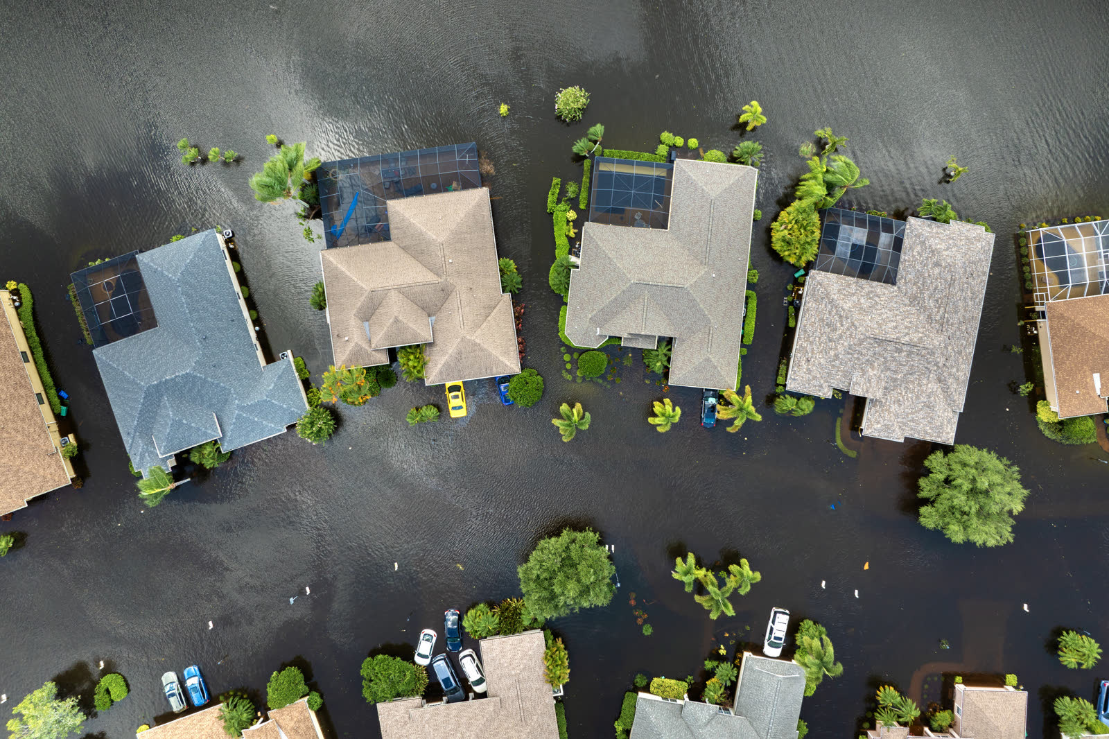
Tropical-storm flooding, Florida
Tropical-storm flooding, Florida HURRICANELAW.PRO FIELD FOOTAGE

What policyholders learned

  • Quiet decades are when coverage decays. Between Gracie and Hugo, SC coastal property values multiplied while wind deductibles, exclusions, and pool placements accumulated unnoticed. Policies get read after landfall; the gap-check has to happen before.
  • Tide timing, not category, set the water damage. A Cat 4 at low tide produced 11.9 feet of surge; Hazel's Cat 4 on a peak tide produced 18. Flood exposure — and the flood policy decision — can't be judged from wind ratings.
  • Inland is inside the loss footprint. Gracie killed more Virginians by tornado than South Carolinians by wind. Tornado, tree, and rain damage from a "coastal" storm are covered wind perils inland — worth claiming, and often under-documented.
  • Wind-only markets were the coming answer. The post-Gracie decades produced the SC Wind and Hail pool (1971); coastal owners today may hold wind and homeowners coverage from different entities, filing one storm against two policies.
  • The last storm is not the risk model. The market anchored on Gracie's modest $14 million for 30 years; Hugo billed the same coast roughly $4 billion. Insure to the historical worst case, not the recent average.

Independent informational resource — not legal advice. Damage figures are nominal (not inflation-adjusted) unless noted. Insurance-law summaries are drafted for education; consult an attorney about your specific claim.

AT LANDFALL · HURRICANE GRACIE · 1959
11.9 ft
OF STORM SURGE · SOUTHERN SC COAST
HURRICANELAW.PRO FIELD FOOTAGE
03 THE FULL RECORD

Every official record of Gracie

Reports, imagery archives, flood data, and claims records — straight from the agencies.

OUR LAW FIRM PARTNER · HALVERSEN LAW
Gracie claim denied?
CALL FL941-390-3233CALL SC843-542-0454FREE CLAIM REVIEW
RELATED GUIDES
HurricaneLaw.Pro HURRICANELAW.PRO

The independent policyholder resource for Florida & South Carolina — storm archive, coverage law, denials, bad faith, and the complete claims playbook. 51 storms · 46 carriers · 97 public-adjuster firms · 37 city guides.

▸ SEE THE FULL SITE MAP — EVERY PAGE →
STORM ALERTS SOURCED FROM NOAA / NHC
SOUTH CAROLINA
496 Bramson Court, Suite 100
Mount Pleasant, SC 29464
CALL OR TEXT
FLORIDA
Tampa, FL
CALL OR TEXT
CLAIMS 9
DENIALS 8
BAD FAITH 7
COVERAGE 12
COMMERCIAL 8
ROOFS 8
TREES 5
DIRECTORIES
STORMS 51
WEATHER
NEWS & SITE 19
STORM ARCHIVE, CITIES & NEWS
Most recent below. Every storm dossier, city resource, and article is on its hub (linked at each heading) or the grouped site map →. All 46 carriers and 97 public-adjuster firms are in the Directories column above.
STORM ARCHIVE · 51 →
Hurricane Debby 2024Hurricane Helene 2024Hurricane Milton 2024Hurricane Idalia 2023Hurricane Ian 2022Hurricane Nicole 2022Hurricane Ida 2021Hurricane Laura 2020 View all 51 →
FLORIDA CITY RESOURCES · 29 →
Boca RatonBradentonCape CoralClearwaterDaytona BeachDestinFort LauderdaleFort Myers View all 29 →
SOUTH CAROLINA CITY RESOURCES · 8 →
BeaufortCharlestonColumbiaFlorenceGreenvilleHilton Head IslandMount PleasantMyrtle Beach
NEWS & UPDATES · 19 →

HurricaneLaw.Pro is an independent informational resource, not a law firm. Coverage summaries, policy-language quotations, dollar figures, deadlines, and chart examples throughout this site are general information based on typical or standard policy forms and are illustrative only — they are not a quote, a guarantee of coverage, or a promise of any outcome. Every insurance policy is different: your own policy, endorsements, and state law control, so read your policy and confirm current statutes. Weather imagery courtesy of NOAA, the National Hurricane Center, and the National Weather Service. Legal services are provided by our law firm partner, Halversen Law. Nothing on this site is legal advice; consult an attorney about your specific claim.

PrivacyTermsDisclaimerAboutContact
© 2026 HURRICANELAW.PRO — ALL RIGHTS RESERVED 27.9°N 82.5°W · ATLANTIC BASIN MONITOR
OUR LAW FIRM PARTNER
Halversen Law LICENSED · FLORIDA & SOUTH CAROLINA

All legal matters on this site are referred to and handled by our law firm partner, Halversen Law, a licensed law firm in Florida and South Carolina. HurricaneLaw.Pro is an informational resource and is not itself a law firm.

FREE CASE REVIEW