
The storm
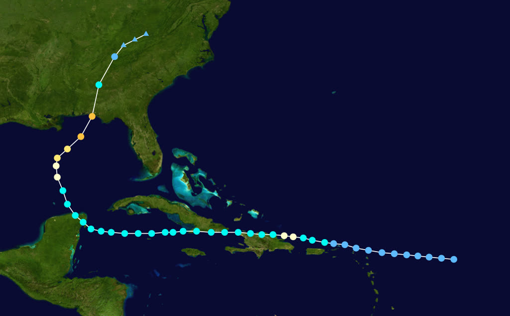
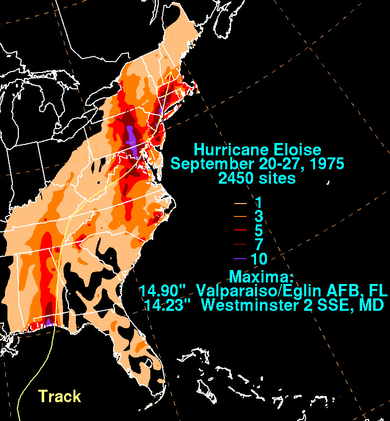
Eloise came off Africa as a tropical wave on September 6, 1975, organized east of the Virgin Islands a week later, and spent its Caribbean phase as a rainmaker, up to 33.29 inches at Dos Bocas, Puerto Rico, and deadly flooding across Hispaniola.
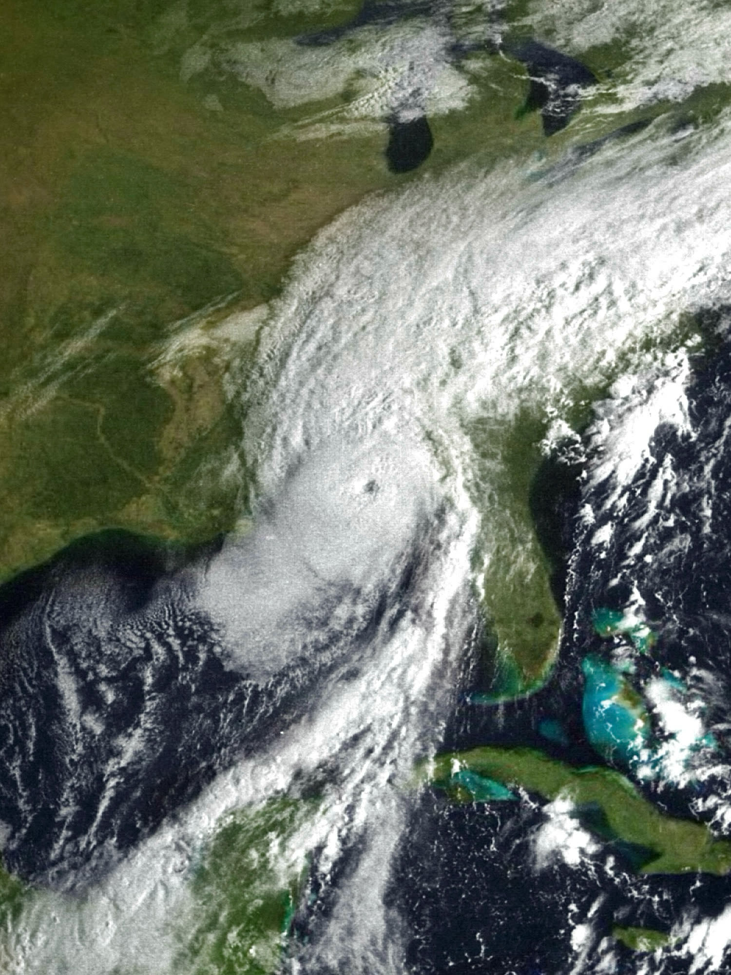
The Gulf changed it. After crossing the Yucatan Channel, Eloise intensified fast over warm water and turned north. On the morning of September 23 it made landfall on the Panhandle west of Panama City as a Category 3: 125 mph sustained winds, 955 mb, gusts estimated to 155 mph. Storm surge ran 12 to 16 feet above normal, locally 18 feet, driven onto one of the most development-crowded low beachfronts in Florida.
Eloise weakened quickly over Alabama, but its remnants merged with a frontal system and dropped 7-10 inches of rain on the Mid-Atlantic, flooding Pennsylvania river towns. The full toll: 80 deaths (59 in the Caribbean, 4 in Florida, 17 elsewhere in the US) and roughly $560 million in US damage.
The damage
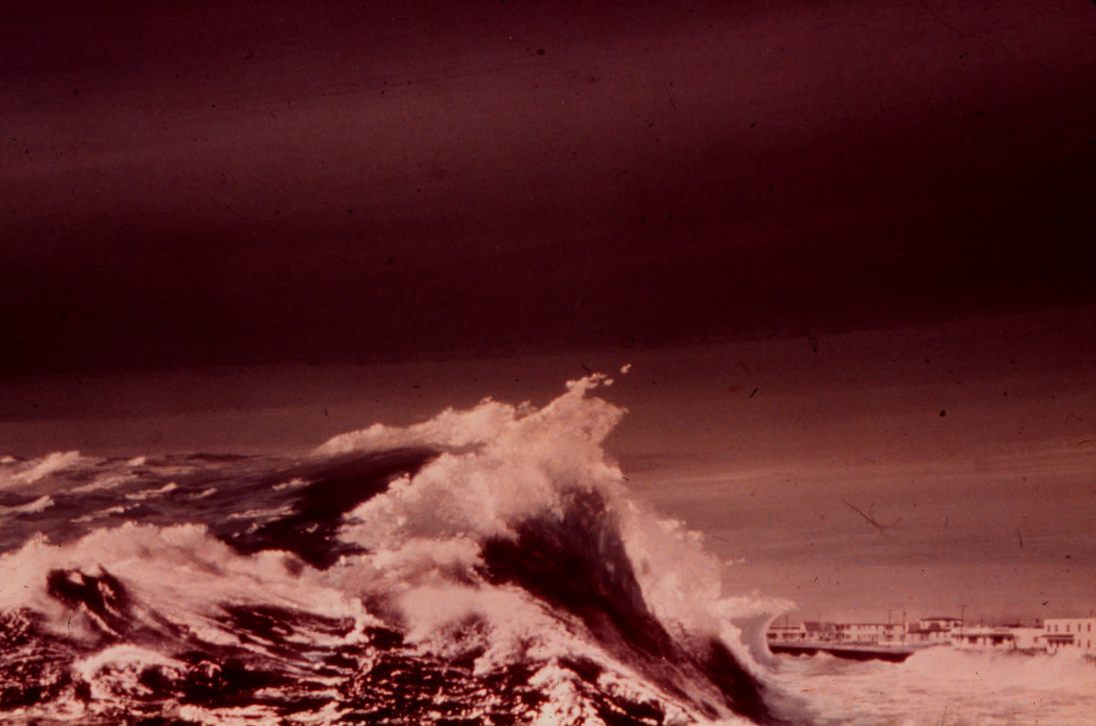
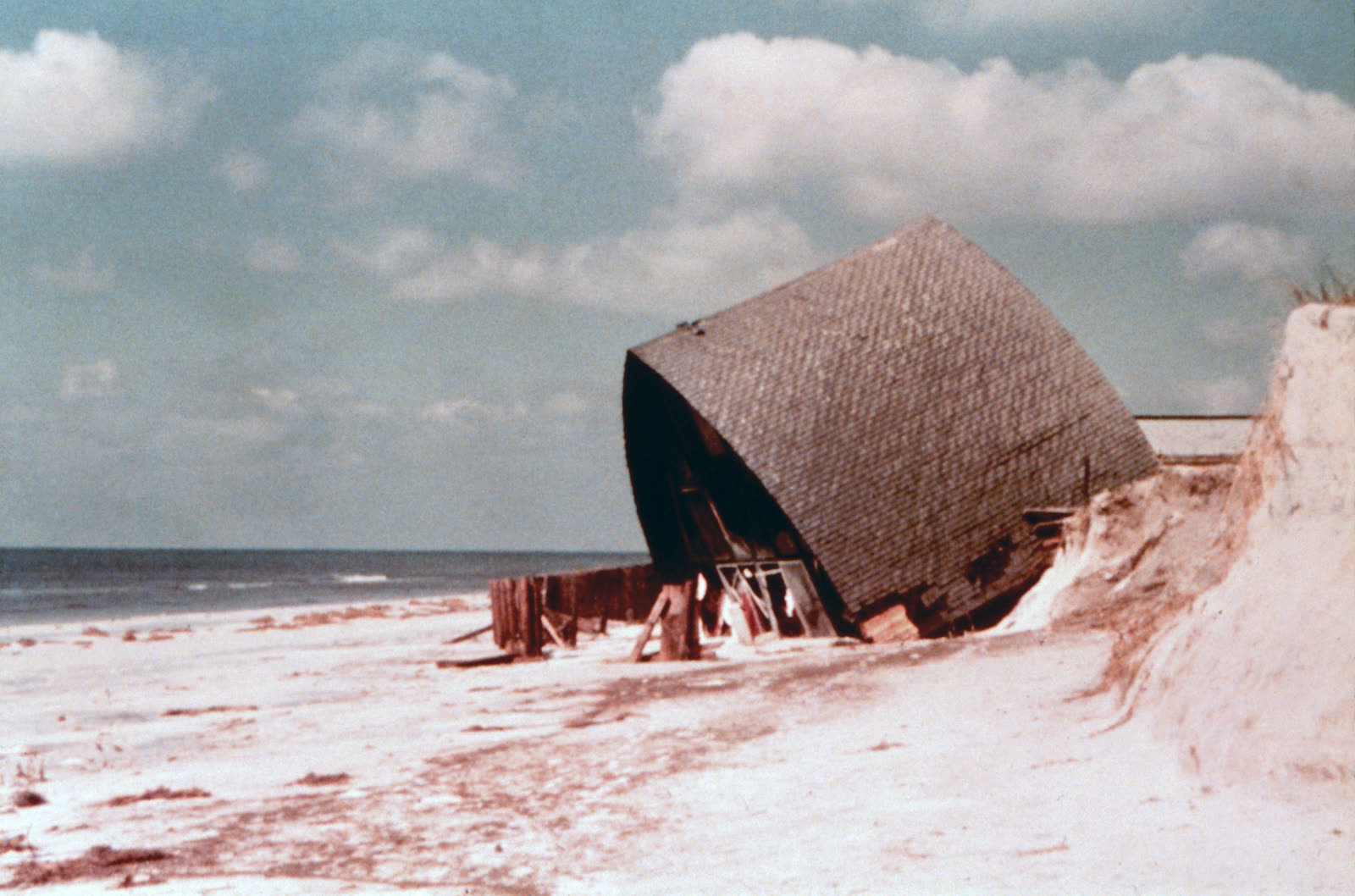
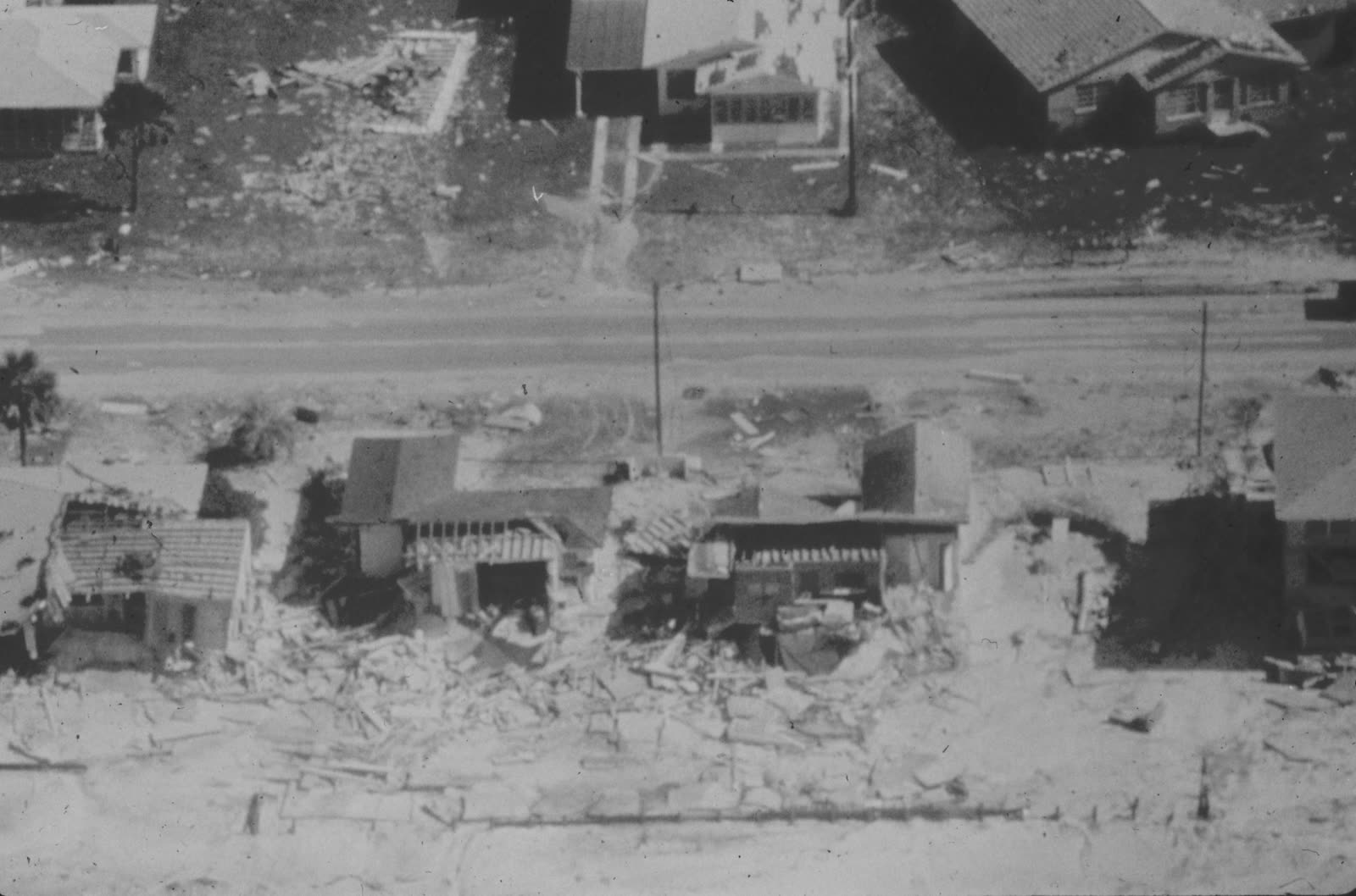
Panama City Beach took the core. Surge and waves demolished the front row of the strand, cottages, motels, restaurants, convenience stores "strewn across the highway," in the words of contemporary accounts. About 500 beach businesses were destroyed and damage in Panama City Beach alone reached roughly $50 million. An estimated 8,000 Bay County residents suffered losses.
The beach itself was a casualty: erosion removed an estimated 801,000 cubic yards of sand from Bay County beaches. The pattern engineers documented afterward was stark, structures built seaward of the state's setback line, on low dunes or open beach, failed; structures behind the dune line largely survived. That observation became policy.
The insurance aftermath
Eloise hit a coastline whose insurance framework was seven years old. The NFIP existed (created 1968), and Bay County's flood claims became the program's first big coastal test. A 1977 Journal of the American Water Resources Association study compared actual Eloise flood losses in coastal Bay County against what NFIP actuarial assumptions predicted, and found premiums insufficient for coastal surge risk. The study's warning, that underpriced flood insurance would subsidize building in the surge zone, became a permanent theme of NFIP criticism.
The regulatory response was Florida's. The state had drawn a coastal setback line in 1971, but Eloise supplied the proof: buildings seaward of it were destroyed at far higher rates. The Legislature responded by strengthening the program into the modern Coastal Construction Control Line (CCCL), county-by-county jurisdictional lines, set by engineering study of 100-year storm surge and erosion, seaward of which construction requires state permits, deeper pile foundations, and elevated floors. Eloise's damage data fed directly into the CCCL methodology the Florida DEP still administers under §161.053, Florida Statutes.
Federal relief filled the rest: President Ford declared a Florida disaster on September 26 (DR-484), and relief across Eloise and its remnant flooding reached about $430 million to 92,000 families. Twenty years later Opal ran a larger surge over the same coast, the CCCL-era buildings survived it demonstrably better, which is why Eloise appears in every Florida coastal-building-code retrospective since.
What policyholders learned
- Surge losses fell to the NFIP or nowhere. Wind policies excluded the water that did most of the beachfront damage; owners without 1968-era flood policies had only federal relief.
- Where a building stood mattered more than how it was built. Seaward of the dune line, construction quality barely changed outcomes, the finding that produced the CCCL's location-based permitting.
- Underpriced flood premiums are not a bargain. The Bay County post-Eloise study showed coastal NFIP rates lagging real risk, a gap later reforms (and premium hikes) kept trying to close.
- Commercial beach strips concentrate uninsured exposure. Small motels and beach businesses, many underinsured for surge, made up the bulk of destroyed structures.
- Post-storm engineering surveys drive law. Damage documentation after Eloise, what failed, at what elevation, how far from the dune, became the CCCL's evidentiary base; the same survey data now decides individual claims.
Not legal advice; consult an attorney about your specific claim. Damage figures are nominal (not inflation-adjusted) unless noted.